Sea Otters Of Alaska
An Earthwatch Project
Introduction * Travel * People * Camp * Otters * Scenery * Animals * Diary * Links *
Scenery
Snow-capped mountains reaching down to the ocean. Craggy peaks towering over deep green forests. Distant hills reflected in mirror seas.
From the plane flying to Cordova from Seattle you can see that Alaska is big. The mountains go on to the horizon. The glaciers shine up at you, green and turquoise. From the ground you are more in the scenery than looking at it.
For most of the bay, the mountains are wooded down to the water, where a small strip of tidal beach draws a thin gray line between the green and the blue. The woods seem impenetrable to humans, but the bears must know the way through the densely packed fallen trees and undergrowth. Following them to learn their paths would seem foolish though.
The beaches consist of gray shale gravel, with occasional rock formations. In the tidal pools we found hundreds of starfish, some small crabs, and a few little fish.
As part of the work for the project we did some surveying of the study area. During low tide we walked a section of shoreline, with Randall noting the change in shoreline type - from say, gravel to mud. We would log the position and take digital photos of the beach. Eventually Randall hopes to have a complete detailed database of the inter-tidal region in Simpson Bay.
Another phase of the work was surveying the bottom of the bay. This is where the otters feed so it is essential to know what is going on down there. We used two techniques to probe the depths. Firstly, a small camera and torchlight mounted on a plate were lowered down from the boat. A screen mounted in a box on the boat displayed the pictures from the camera. As the boat drifted along slowly the viewer would describe the scene - mud, gravel, rocks and various small creatures.
We also used an Eckman grab to take samples of the sediments on the bottom. This device is lowered to the ocean bed, and once the operator is happy that it is lying square on the surface a length of pipe is dropped down the line. This triggers the grab to close and a portion of whatever it is sitting on is captured. The unit is hauled up and the sample is bagged.
Well, that's the theory. Sometimes the grab jams on a rock and comes back empty. Or the jaws don't close. But that tells you something about the surface. A good grab brings up a couple of handfuls of mud or gravel. Occasionally we'd find something interesting, like a clam or small starfish.
Once back at base we put the samples through a series of filters to determine the amount of gravel through to fine sand. Once all the survey stations in the bay are done, the plan is to correlate otter behaviour with sea bottom type.
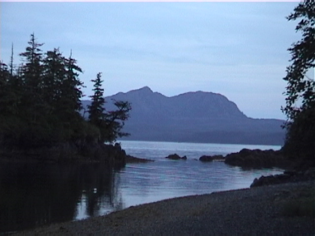
View From Camp.
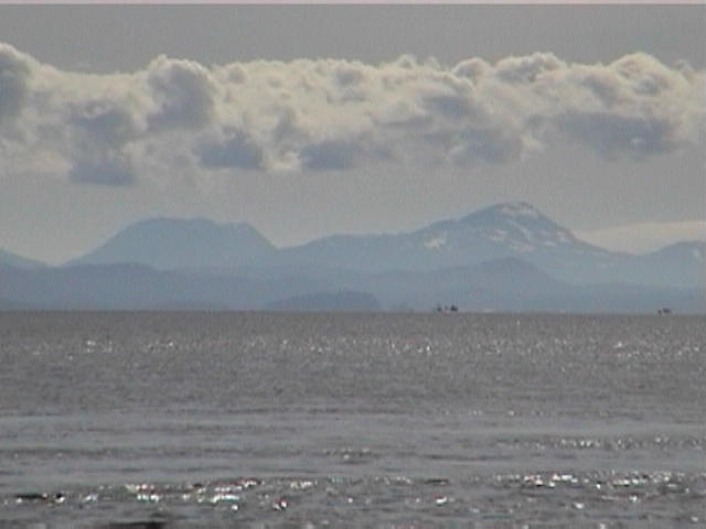
Looking south from Simpson Bay
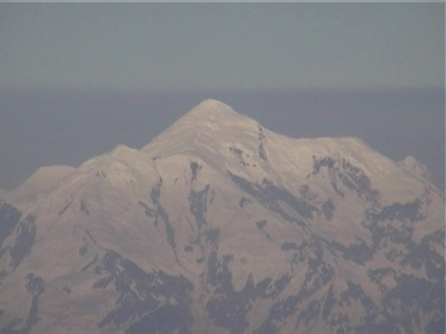
View from the plane leaving Cordova
Pages by Baz